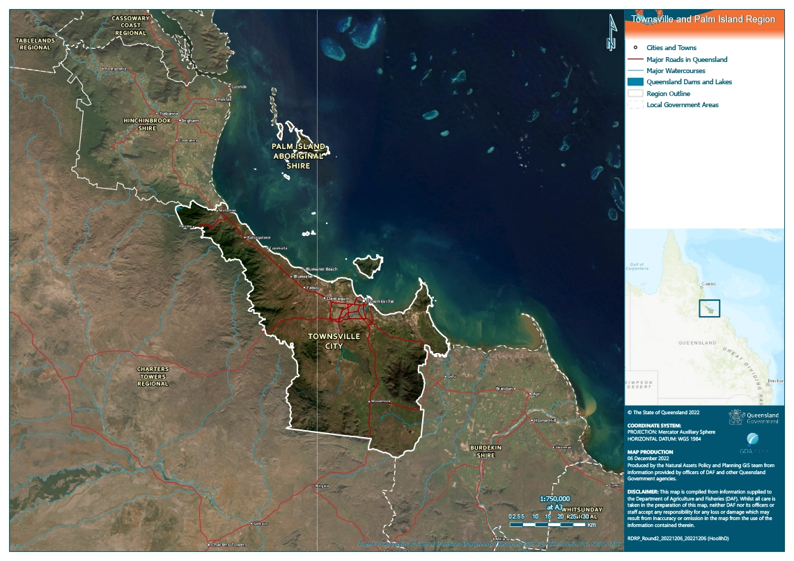
Figure 5: Townsville and Palm Island Regional Map.
The Townsville and Palm Island region is no stranger to natural disasters and hardship – cyclones, floods, droughts and economic downturns are regular events and have created a resilient and adaptable culture, one that recovers from local events and supports the wider north Queensland in its time of need.
The region is home to over 200,000 people and spans across 72km² and 3730.8km² of northern Queensland’s wet and dry tropics respectively. The region is located along the North Queensland coast and features both wet and dry tropics environs, world heritage areas, the Great Barrier Reef and a thriving city.
The Townsville and Palm Island regions have a long history of prolonged dry seasons, with the majority of Townsville situated within the dry tropics. Despite the region’s familiarity with drought, the slow-moving and unpredictable nature of the duration and severity of such events can generate devastating and long-standing effects. Given the absence of a significant agriculture sector, the Townsville and Palm Island region has historically been impacted by drought differently to the neighbouring local government areas.
Past impacts of drought in this region
Past impacts | Townsville
EXTRACTS FROM THE FULL RDRP PLAN
Floodplain, Townsville
Townsville’s economy is not only affected by drought within the confines of the LGA boundary – as an economic centre for North Queensland, it is also impacted by drought in surrounding areas.
When there is a drought in Western Queensland, the Townsville economy has been known to experience a short uplift as graziers destock and send cattle for processing, and purchase feed and storage or watering systems. However as the drought progresses and the meatworks and the Port of Townsville slow down, and there is no available money to spend in the city, Townsville experiences a down turn. The precise scale of this economic impact has not been reliably quantified, however it is generally accepted as an impact.
Lawns, gardens, parks and green spaces are highly valued by the Townsville community. As such, hot and dry conditions increase community stress and create angst when water is not available or is too expensive to maintain the desired amenity. Much to the chagrin of political leaders and tourism leaders, Townsville has historically been given the unflattering nickname of “Brownsville”. Despite attempts to shake this title and green the city, every time there is an extended dry and the city cannot maintain the watering levels required for a lush green environment, the negative reputational damage reoccurs and community pride and satisfaction drop.
The heatwaves associated with drought are known to cause physical illness and psychological stress – especially in the aged population, or those in lower socioeconomic circumstances who cannot afford to install or run air cooling technologies.
The Townsville region also experiences bushfires on its outskirts almost annually. As the urban spread continues and housing estates are created on the edge of these bush areas, the risks to housing and property becomes greater.
Past impacts | Palm Island
EXTRACTS FROM THE FULL RDRP PLAN
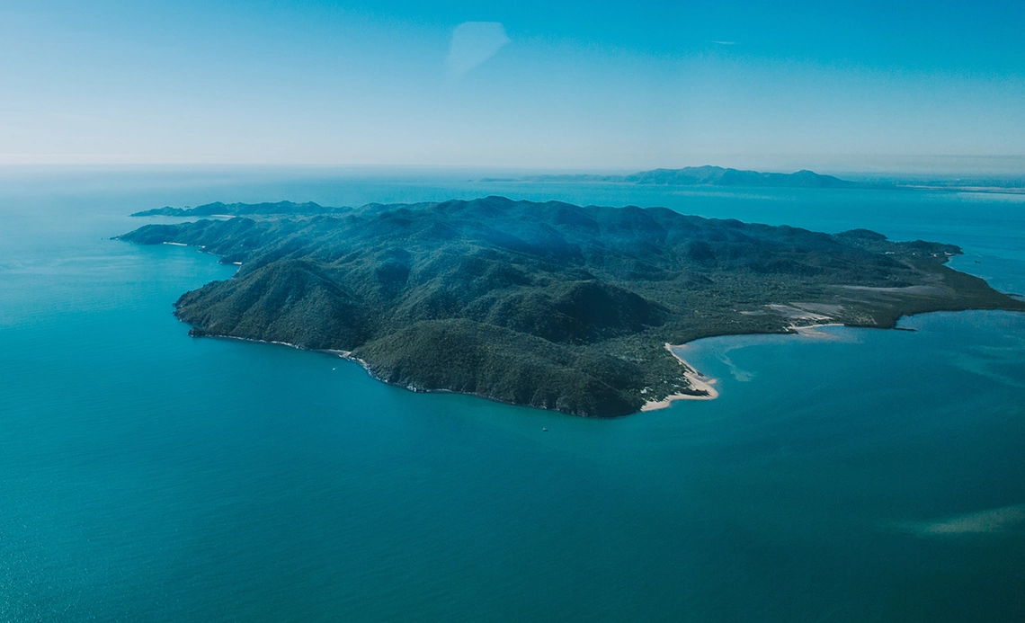
Palm Island. Source: Selectability Palm Island.
With its high unemployment, absence of commercial activity, and reliance on government delivered services, Palm Island experiences drought largely through its impacts to the environment and the community.
Historically, portions of the population have been relocated to Townsville, Ingham or other coastal towns during droughts, as the island did not have enough potable water to support its population. This led to social disruption as families were split and found themselves incurring significant costs to visit the mainland to enable family to be together. The disruption also affected the continuity of children’s education and the level of services available on the island. Great Palm Island is surrounded by the Great Barrier Reef Marine Park (GBRMP), with the ocean on the western side of the island zoned as a Habitat Protection zone. Such a sensitive environmental area has been subject to the damaging effects of cyclones, floods, and heat waves and droughts. In fact, researchers are investigating the impact of the climate and how it has impacted the surrounding GBRMP, particularly the effects on corals of increased temperature. Reduced rainfall both in quantum and seasonality is also affecting the rainforest covering the bulk of the island.
Likely future impacts of drought in this region
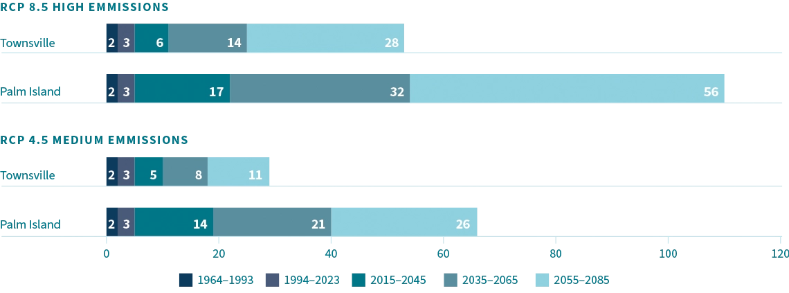
Figure 23: Average number of hot days, Townsville and Palm Island LGAs 1964 to 2085
Projections for future climatic conditions for the Townsville and Palm Island region indicate an increase in temperature and a rainfall pattern becoming steeper and deeper – that is, heavy rainfall over a shorter period of time. The latter is particularly problematic in that once water storage facilities such as dams are full, additional rainfall cannot be captured and if the period between rainfalls is longer, the storage top up time is extended.
The number of hot days (above 35°C) in the regions are estimated to significantly increase between 2030 to 2090, particularly for Great Palm Island. Under one projected scenario, Great Palm Island is expected to increase from an average of three hot days annually to approximately 56. Townsville is expected to experience a significant increase to a smaller extent relative to Palm Island, increasing from three heatwave days on average to 28 days. These climate changes will likely have significant impacts on industries. This is particularly pertinent for the Townsville region, which is an integral component of supply chains for the agricultural and livestock industries of the North West.
Future impacts | Townsville and Palm Island
EXTRACTS FROM THE FULL RDRP PLAN
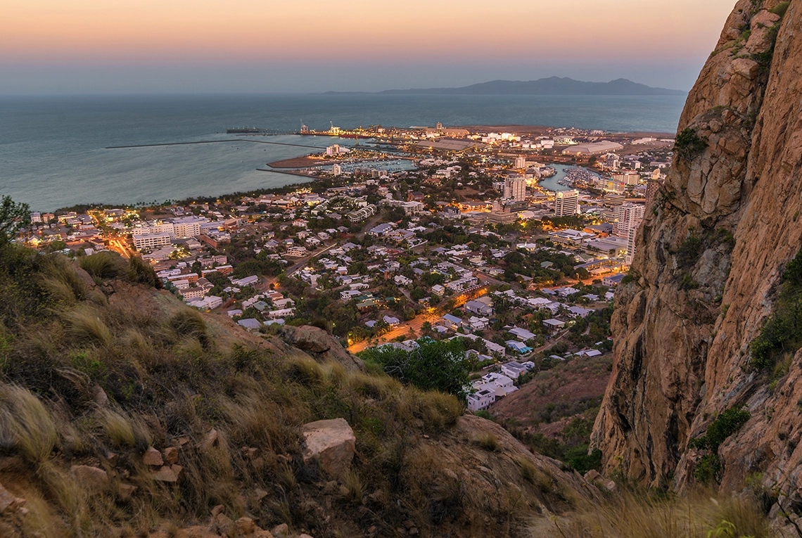
View of Townsville City from Castle Hill
Increased demand for support services.
The demand for physical and mental health support, social services, natural environment protection and sustainable infrastructure will be increased in direct proportion to future drought events.
Ferry landing at Palm Island. Source: SeaLink.
Increased risks to planned growth opportunities.
Townsville’s planned growth is predicated on a sufficient supply of water for industry and residential use. Water is crucial to a liveable environment and connectivity to the remainder of North Queensland as suppliers of human and material resources for the economy. A period of unprecedented drought poses a serious risk to this growth opportunity which would not only impact the local context but could have state, national and international ramifications. Assuming Townsville does continue its planned economic growth in the event of a drought, this will increase the impact on the growing population and current environment.
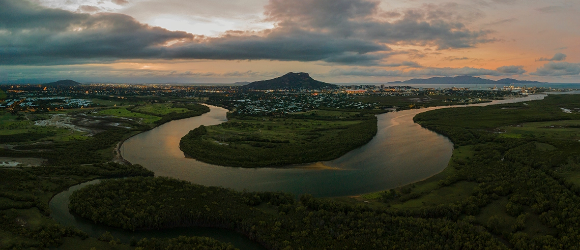
Ross River, Townsville
Increased stress on key networks.
Increased stress on electricity networks, emergency services, hospitals and infrastructure. Additional road damage and transport delays when railway lines buckle under the extreme conditions.
Regional strategy
Water security
The region has:
sufficient water supply and storage facilities for its current and future needs, including diverse water sources and supply contingency plans
a reliable supply of safe drinking water
affordable water for its needs.
Resilient natural environment
The region has a resilient natural environment characterised by:
open landscapes:
supporting biodiversity (plant and animal)
managing the risk of uncontrolled fire
focusing on natural systems’ restorative and sustainable practices.
community places:
featuring climatically appropriate vegetation and management practices
demonstrating restorative and sustainable practices.
including cool city initiatives.
Resilient community
The region is characterised by a community that:
Is Drought Resilience aware and informed, and demonstrates drought resilience practices.
Is connected and supports its members.
Has the human and social capital to deal with drought (including risk literacy).
Has sufficient community support services to build community capacity for resilience.
Resilient economy
Regional economic stakeholders:
Are aware of, and prepared for, the impact of drought in neighbouring regions.
Demonstrate innovation in the use of water.
Have business contingency plans demonstrating risk literacy, and drought and disaster preparedness.
Resilient infrastructure
The region has:
infrastructure facilitating drought resilience
urban design supporting hot and dry conditions
water sensitive design and innovation.
Strong regional governance
The region has:
An effective framework for building capacity and facilitating coordination of drought resilience partners to plan, deliver, and monitor drought resilience.
View the Townsville and Palm Island Regional Drought Resilience Plan